Ethnographiska, historiska och statistiska anmärkningar. 004
Title
Ethnographiska, historiska och statistiska anmärkningar. 004
Description
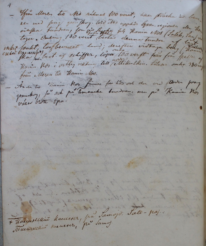
| Addition at the end of the page: «Канинскiй камень, på Samoj[e]d[isk]: Sale-paj. Тиманскiй камень, på Samoj[edisk]» Ifrån Mesen till Nes
räknas 100 verst, hken[hvilken] sträcka är bemär-Nesʹ is situated on the shore of the River Nesʹ (TN Хэйяха) near the west coast of Kanin Nos at N66°36′2″ E44°40′44″. (TS, KL)
ken med svag granskog. Wid Nes upphör l[ärk]gran-regionen den Kaninska tundran,
The name Kaninskaja tundra is often used for the Kanin Peninsula (TN Саля) and the area between Mezenʹ Bay and the River Pëša. (NAO-ES, 119–120.)
som på Ryska kls[kallas] Kanin Nos (Sal'eh, Sam[ojedisk].) vid tager omkring 100 verst från Nes består denna tundra af lågt <---> sankt, torfbevuxet land; derefter vidtaga berg, (Kaninska)
Kanin kamenʹ (TN Саляʹ пай) is a ridge in the northern part of the Kanin Peninsula.
(Канинскiй каменъ) Kanin Nos i östlig riktning till udden Mikulkin.
Således omkr[ing]. 380 verst från Mesen till Kanin Nos.Mysʹ Mikulʹkin or Mikulkin Nos is the easternmost point of Kanin Nos at N67°48′39″ E46°41′37″. (TS)
|
«Kaninskij kamenʹ, TN Sale-paj. Timanskij kamenʹ [TN translation missing])» The distance from Mezen' to Nes is 100 versts, and the land between them consists of shabby spruce forest. Around Nes the larch tree areas cease at the Kanin tundra (Sal’eh), which in Russian is called Kanin Nos (TN Sal'eh), and start about 100 versts from Nes. This tundra consists of low <---> soft, peat-covered land; the mountains, extend from Kanin Nos to the east to the Mikul'kin headland. Therefore, around 380 versts from Mezen' to Kanin Nos. |
| Ända till Kanin Nos finnas här och der vid floden svag granskog, så ock pä Timanska tundran, men på Kanin Nos växer blott <Era>.
dwarf birch (Betula nana)
|
As far as Kanin Nos, shabby spruce forests are found here and there by the rivers, which also concerns the Timan tundra. But on Kanin Nos only dwarf birch grows. |

